ParaJam in the Ham

Pilot Information

Ground operations, camping layout, and key pilot notes.
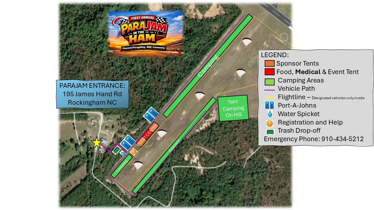
Airfield + Camping Map

Ground Map

Open Full Size

This combined map covers event entrance, sponsor and event areas, camping zones, vehicle flow, flightline boundaries, water, registration, trash, and emergency contact.

ParaJam ground map showing entrance, event center, camping areas, flightline, vehicle path, water, registration, trash, and emergency phone number.

Tip: tap the map to open full size on mobile.

Arrival

Use This Entrance

195 James Hand Rd
Rockingham, NC

Follow event signage and staff directions once you arrive on-site.

Status

Flying Area Map

Not posted yet. This page will be updated when the separate flying-area map is ready.

Camping

Know Before You Park

  • Dry camping only — no hookups.
  • Generators are allowed.
  • Water is available on-site, but there are no water connections.
  • Use designated camping areas shown on the map.
Ops & Safety

Ground Rules

  • Keep vehicles on the marked vehicle path unless directed otherwise by staff.
  • Respect the flightline boundary and designated-vehicle rules.
  • Registration and help are marked on the map near the event center.
  • Emergency phone: 910-434-5212